
Reference: ASPION GmbH Live-Tracking
Keep an eye on your transports and manage risks with SmartMaps
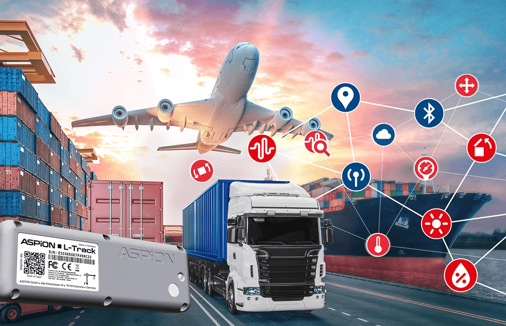
Live tracking of valueable goods
ASPION uses the mapping platform from YellowMap AG to deliver innovative transport monitoring - giving shippers access to secure, real-time data visualisation.
When sensitive goods are on the move, a great deal is at stake. Shipments must be traceable as seamlessly as possible to ensure full transparency, particularly in the event of an insurance claim. High-value assets such as high-tech machinery, industrial components, medical equipment, or precision measurement devices can incur damages worth several million euros during transportation. When that happens, the crucial questions are: What occurred, where did it happen – and above all, who is liable?
The solution for the highest demands - easily integrated via API
“Our solution is based on the Cloud of Things by Deutsche Telekom,” explains Martina Wöhr, Managing Director of ASPION GmbH. “We wanted to combine it with an external mapping technology, as the map feature included in the Telekom product did not meet our requirements.”
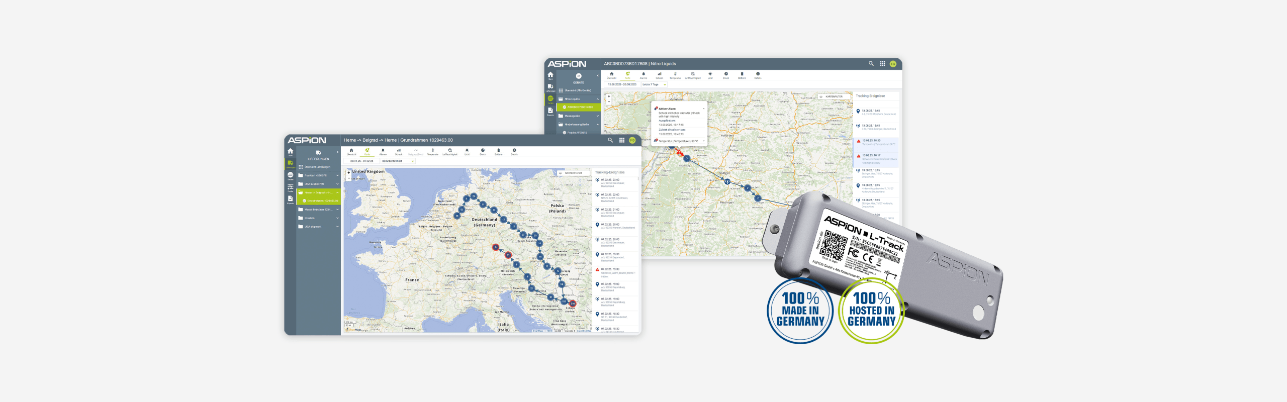
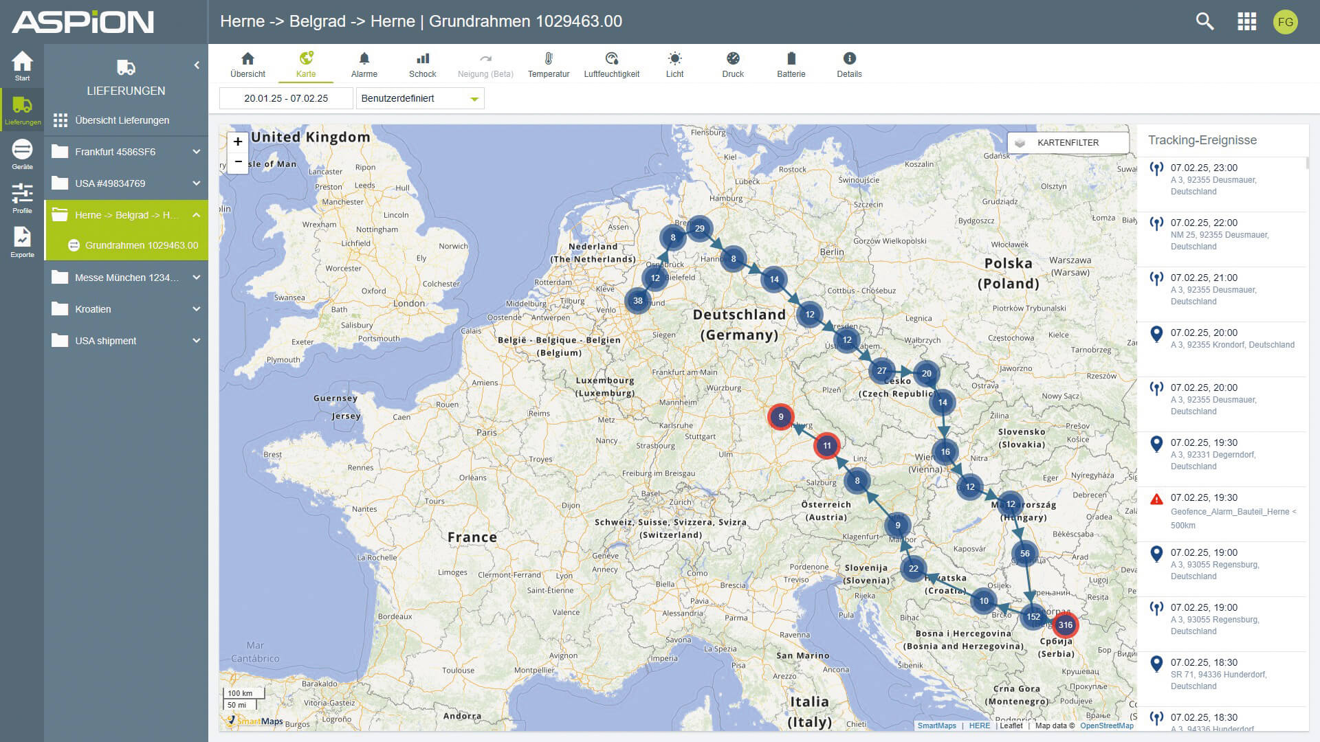
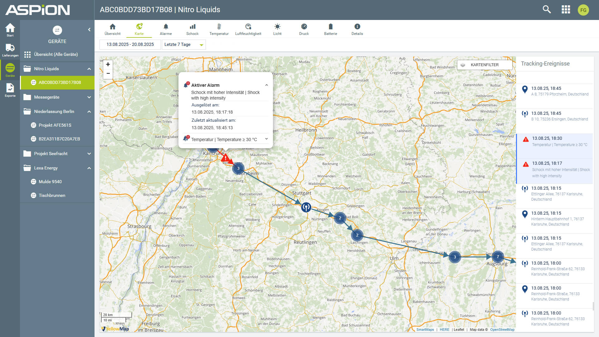
The choice fell on SmartMaps. “This solution enables us to visualise even highly complex tracking data.” For example, ASPION can differentiate between multiple location tracking technologies such as cellular positioning and GPS tracking. All tracking data and transportations are georeferenced. Transport routes are displayed with directional information.
“A key advantage was the easy integration of SmartMaps via API,” adds Josia Fritz, Product Owner at ASPION. Using a individual API-Key, the IT team seamlessly integrated the cloud-based mapping solution into their existing software environment — without extensive coding, complex development processes, or long implementation times.
Benefits and advantages
- Visualisation of complex tracking data in real time
- Easy integration of SmartMaps via API
- Hosted in Germany
- High data-security with full GDPR compliance
Features and use cases
- Worldwide maps for transportation visualisation
- Flexible map layers for customised data display
- High-performance global geocoding
- Seamless integration into existing systems
SmartMaps visualises complex data
By integrating the SmartMaps mapping platform ASPION GmbH provides shippers with a reliable and secure solution for global transport monitoring. As part of a multifunctional Internet of Things (IoT) platform, SmartMaps delivers a key component for advanced geospatial data visualisation. Combined with the ASPION L-Track data logger, customers benefit from a powerful end-to-end IoT tracking solution. Equipped with state-of-the-art sensors and wireless transmission technology, the compact device is attached directly to the shipment and continuously monitors its condition throughout the entire supply chain.
The collected tracking data is transmitted to the ASPION Cloud platform, where shipments can be tracked in real time. The system provides detailed analytics and reporting, including temperature monitoring, humidity tracking, and detection of unauthorized opening events. In case of critical incidents such as shock or vibration, automated alerts are triggered instantly. SmartMaps transforms complex tracking data into clear, interactive map visualisations — displaying transport routes and location markers for worldwide locations and alerts.
Clever handling
“SmartMaps stands out with its intelligent handling of multiple map layers,” says Martina Wöhr. Individual layers can be activated or deactivated as needed. With just one click, users can switch between different types of location data — from cellular positioning to accurate GPS tracking — as well as alarm markers, displayed with timestamps and the exact geolocation.
“We were able to independently customise the individual layers to meet our specific requirements. Our ideas for the graphical display of directional arrows and alert icons were also implemented quickly,” reports Fritz, emphasizing the strong technical support provided by the team at YellowMap AG. “Communication is always straightforward and solution-oriented — we are extremely satisfied.”
Martina Wöhr, Managing Director ASPION GmbH
Powerful features
“The SmartMaps mapping solution not only combines all the functionalities we require. Its visualisation is intuitively designed and stands out with a clear, well-structured, and user-friendly interface. That is what truly differentiates our application,” says Martina Wöhr.
Hosted in Germany
The high level of data security provided by the GDPR-compliant SmartMaps mapping platform was a decisive factor for ASPION GmbH, emphasizes Martina Wöhr. “Our customers do not want transport data to leak uncontrollably or be accessible to unauthorized third parties.” The combination of the Telekom platform and SmartMaps now forms a robust and trustworthy end-to-end solution. “All components are resilient, transparent, and reliable. End-to-end hosting in Germany is a fundamental requirement for us and builds trust — especially with the rightly critical IT departments of our customers.”
Reliable address matching
“The geocoding — meaning the conversion of addresses into geographic coordinates and vice versa — is highly accurate and reliable with SmartMaps,” praises Josia Fritz.
Instead of cryptic coordinates, users see clear street and place names. This significantly improves orientation and enables faster decision-making — especially in time-critical situations, such as when the system detects a shock event and immediate action is required.
High performance
“High performance is not a nice-to-have in live tracking, it is essential,” emphasizes Martina Wöhr. “SmartMaps stands out with very fast response times and very intuitive usability. When zooming in and out, the map view loads very quickly. Depending on the zoom level, tracking points are intelligently clustered or displayed in greater detail. The closer you zoom in, the more detailed the information becomes. All of this directly contributes to high user satisfaction and excellent usability. This is something we place the highest value on in our products.” - Martina Wöhr.
I’m happy to help - how can I assist you?

Christopher Schmitt
Maps-Specialist
Tel.: +49 721 9638-125
geosolutions@yellowmap.de