SmartMaps Monitor
Visualise. Recognise. Decide.
Discover new trends and patterns from data with a spatial reference. Utilise these valuable insights to make well-informed decisions and ensure sustainable success.

Clear visualisation
A glance says more than 1,000 words: It enables you to understand and present data quickly and easily.
Long-term success
Facts, facts, facts: Monitor your processes and make informed decisions.
Complete data sovereignty
No upload necessary: Your data remains GDPR-compliant within your company.
Versatile Applications
SmartMaps Monitor in action
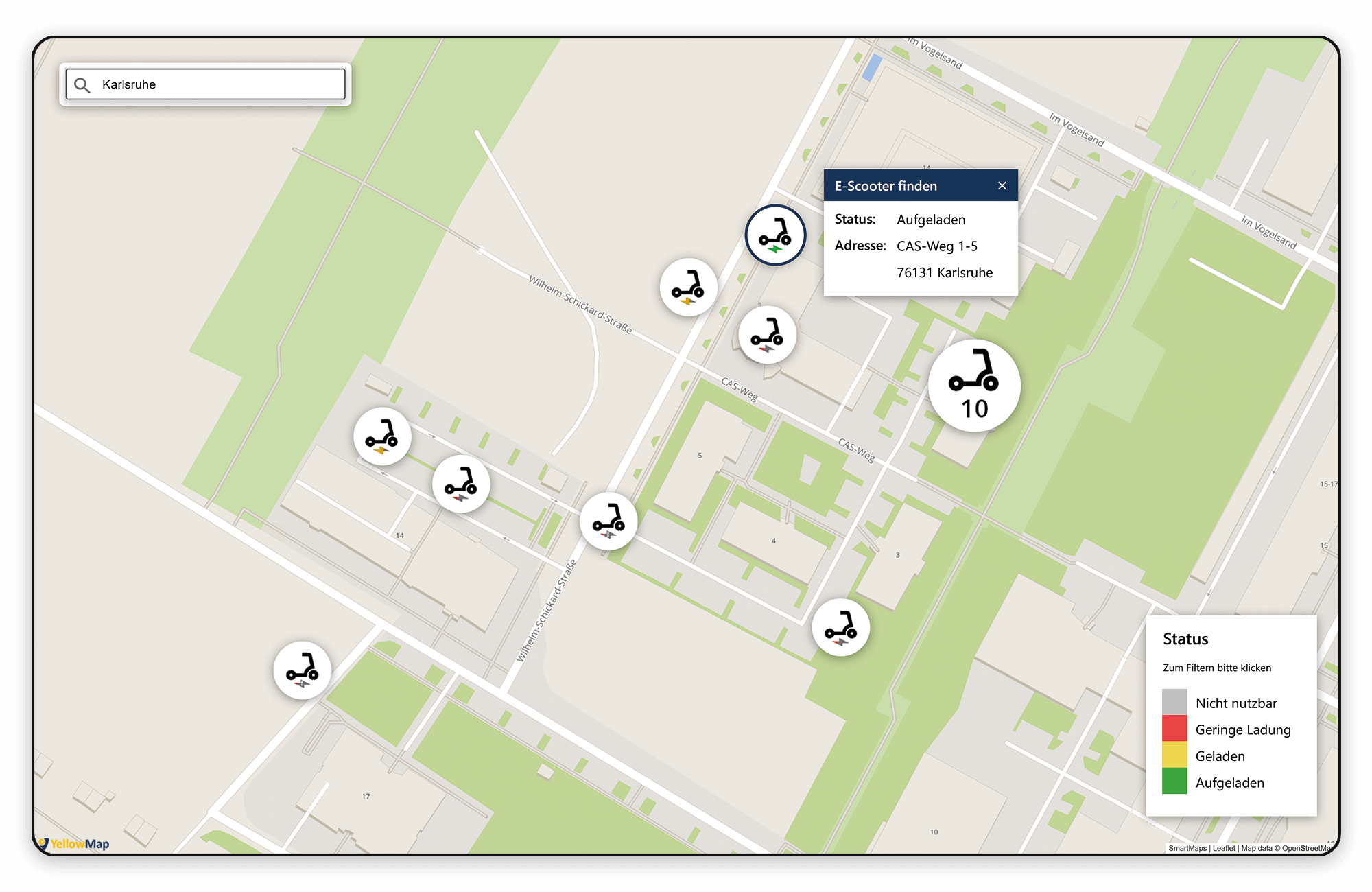
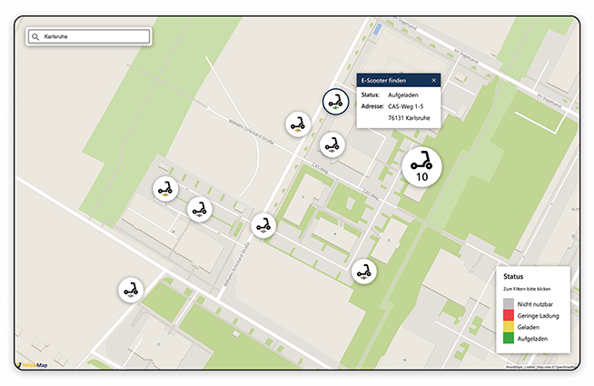
Fast Location Tracking
Always on the move, yet still easy to find: Use movement data to determine the real-time location of your mobile assets and take your service to the next level.
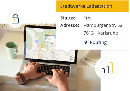
Whether it’s e-scooters, rental bikes, carsharing vehicles, or fleet cars – with SmartMaps Monitor, you can track the positions of your dynamic assets in just a few seconds, fully GDPR-compliant. But that’s not all: You can also monitor additional data such as tire pressure or battery status to ensure top-level service at all times.
Early Risk Detection
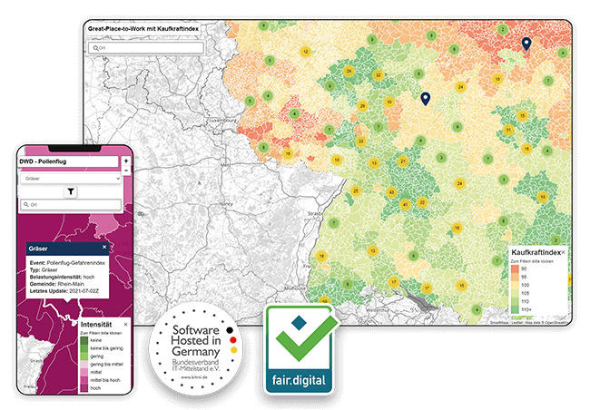
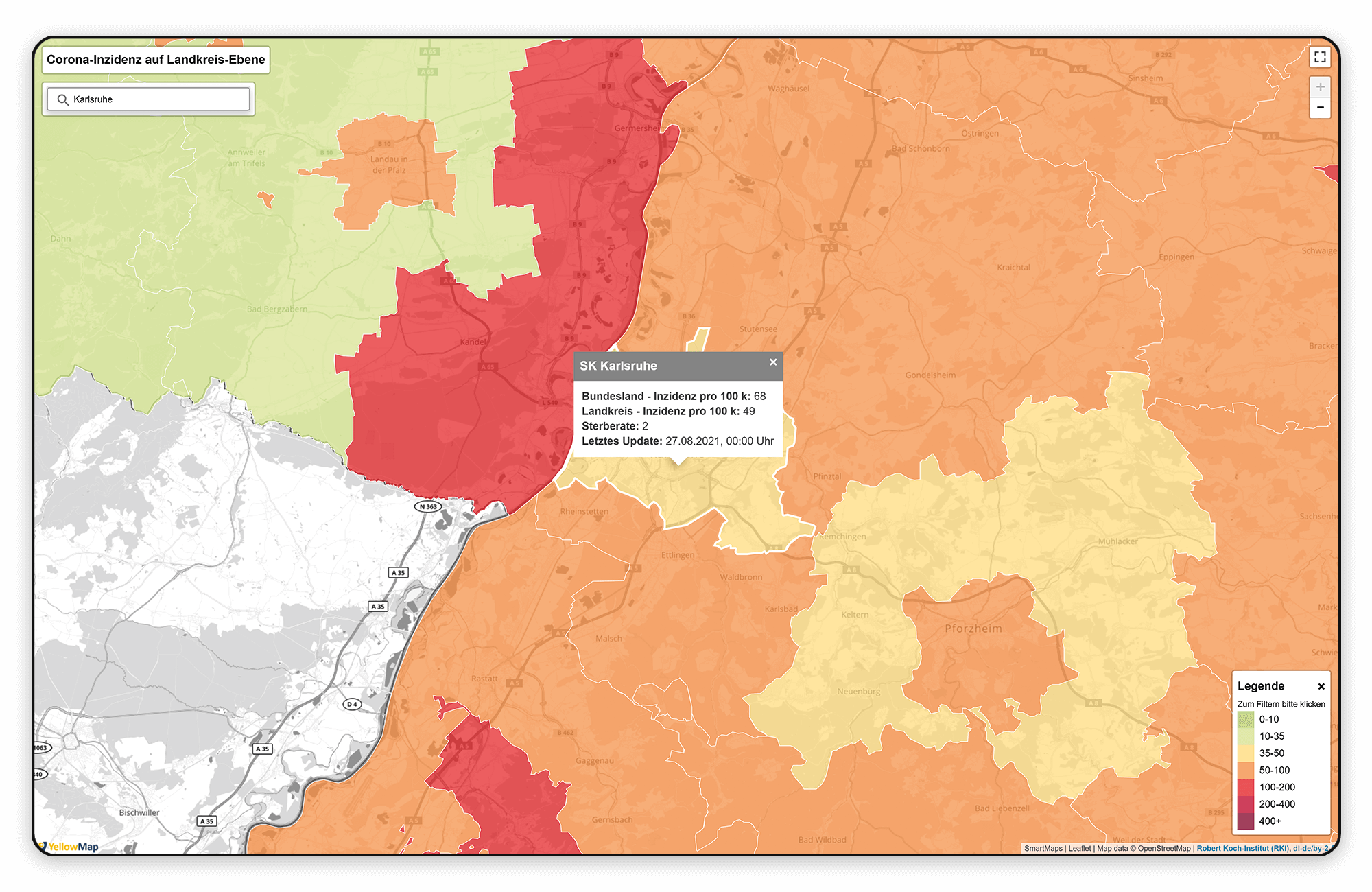
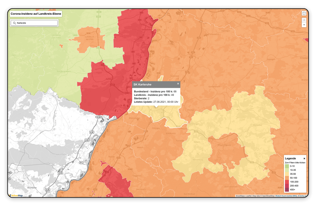
Our environment is also driven by data – data you can use to detect risks early. With SmartMaps Monitor, you can visualise risk areas to take timely action and ensure the safety of your customers, prospects, or employees.
Whether it's pollen levels, UV index, or current COVID-19 incidence rates – SmartMaps Monitor lets you display the development of risk zones directly on your map interface. Use environmental and climate data not only for protection but also to boost your business performance.
Proactive Decision-Making
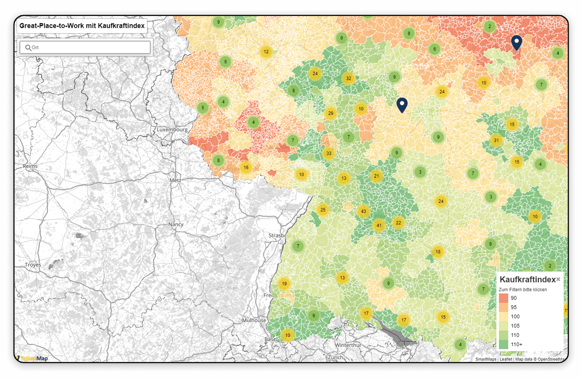
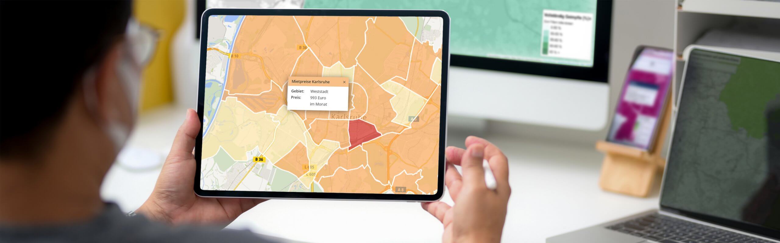
Looking at a map provides more insight and transparency into your data: By visualising information with spatial context, you gain deeper insights, faster understanding, and the ability to act proactively and make informed decisions in time.
Whether it's identifying top-performing regions, analysing rental price trends over recent years, or visualising the distribution of new development and commercial spaces – with SmartMaps Monitor, all key information are just one map view away.

Data Visualisation
for fast insights
SmartMaps Monitor allows you to visualise your data and make knowledge transparent. Thanks to the easy integration of our turnkey component into your existing system environment, you can get started right away and interact seamlessly with the map interface to gain quick insights for informed decision-making. For example, you can display your top-performing locations directly on the map.
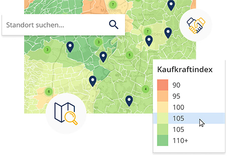
Freedom of Combination
for individual data analysis
For instance, you can visualise real-time information from your IoT devices or display the current locations of your vehicle fleet.
Discover SmartMaps Monitor:
6 Months Free of Charge
Register with your email and domain to use SmartMaps Monitor free of charge for 6 months. Your trial ends automatically – no cancellation required. To continue using the service, simply subscribe for €99 per month, with up to 300,000 transactions per year included.
After registration, you’ll receive a personalised API key via email for integration into your system environment.
Already a SmartMaps customer? Feel free to contact us via email.
Let's unlock your mapping potential together
Your success is our priority - Connect with us now
Have questions or seeking personalized guidance on our SmartMaps platform? I'm here to help. Contact me today for expert advice and support in achieving your goals with our cutting-edge mapping solutions.

Christopher Schmitt
Maps-Specialist
Tel.: +49 721 9638-125
geosolutions@yellowmap.de