

Routing API - fast route planning to your destination
Use the Routing API for more than just classic A-to-B route planning. It also supports matrix routing, isochrone calculation, trip planning, and map matching for a wide range of location-based applications.
Start for free
Discover APIs
Routing features at a glance
Route calculation
With our high-performance routing server, you can calculate routes from A to B in seconds. Show your customers the best way to your location and guide them safely to their desired destination.
- Worldwide available Routing API
- Multiple routing profiles for cars, bikes, or pedestrians
- Flexible waypoints and intermediate stops along the route
- Turn-by-turn directions, distance, and estimated travel time


Matrix routing
Calculate driving distances and travel times between multiple origins and destinations. Ideal for route optimisation, tour planning, location analysis, and catchment area analysis.
- Real-world distances based on the actual road network
- Ideal for logistics and delivery optimisation
- Sort lists by accessibility
- High performance even when processing large route matrices
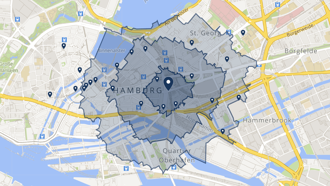
Isochrones
Calculate the reachability and accessibility of any location based on travel time or distance.
- Catchment area analysis
- Time- or distance-based accessibility
- Multiple routing profiles for cars, bikes, and pedestrians
- Calculate multiple isochrones at once (e.g. 5, 10, or 15 minutes)

Trip planning
Use the trip planning API to calculate the optimal route for your tour across any number of destinations.
- Solves the travelling salesman problem
- Simplifies sales visit planning
- Ideal for logistics, sales forces, and fleet management
- Saves time and reduces costs
Map matching
With map matching, we accurately position your fleet's GPS tracks or real-time vehicle data on the map and match them to the underlying road network.
- Precisely matches GPS data to the road network
- Calculates the actual routes travelled by your fleet
- Provides a clear overview of your fleet
- Ideal for logistics, sales forces, and fleet management

Get your customers to their destination faster
Test SmartMaps Routing right here in our demo.
130+
countries covered
100 %
GDPR-compliant
8+
APIs on one platform
200+
customers worldwide
Routing use cases

Location planning
Evaluate potential locations based on accessibility, travel times, and catchment areas.

Logistics
Optimise routes, calculate travel times, and analyse delivery areas for logistics companies.

Catchment area analysis
Isochrones show how many customers can be reached within specific travel times.
Awards & quality seals
YellowMap AG develops and operates SmartMaps in German data centres and holds the most important seals for data protection, data security, and digital sovereignty.

Certified by
BITMi

Hosting in Germany

100% GDPR-compliant

100% fair.digital
Frequently asked questions about SmartMaps Routing
Matrix Routing calculates distances and travel times between multiple origins and destinations simultaneously (n:m matrices). This makes it ideal for route planning, location analysis, and catchment area analysis, as it allows you to determine which branch can be reached fastest by each customer.
I’m happy to help - how can I assist you?

Christopher Schmitt
Maps-Specialist
Tel.: +49 721 9638-125
geosolutions@yellowmap.de
