

Custom mapping projects – from concept to live operation
Need more than a standard map API? We design and develop tailored mapping solutions based on the GDPR-compliant SmartMaps platform – for businesses and agencies.
25+ years of expertise · Made & Hosted in Germany · 99.72% uptime · over 200 customer projects · GDPR-compliant
Full-service for your geospatial projects — all from one source
YellowMap AG, based in Karlsruhe, has been developing custom mapping solutions for businesses and web agencies since 1999. With more than 100 successfully delivered geospatial projects and clients such as Postbank, Sparkasse, OTTO-CHEMIE, Hansgrohe, and reifen.com, our expertise speaks for itself. From the initial concept to ongoing operation, you get everything from a single source.

Consulting & Concept
Together, we analyse your requirements, evaluate technical options, and create a detailed project concept, including effort estimation and a clear roadmap.

Agile Development
Our development team implements your solution on the SmartMaps platform using an agile approach, with regular feedback and transparent sprints.

Operation & Support
Hosting in ISO 27001-certified data centres in Germany, ongoing maintenance, updates, and a dedicated account manager ensure your solution runs reliably in the long term.
Examples of individual mapping projects
YellowMap AG develops custom mapping solutions for all common business systems. Typical integrations include CRM connections for CAS genesisWorld, Salesforce, and HubSpot, ERP integrations with SAP and Microsoft Dynamics, as well as CMS plugins for WordPress, TYPO3, and Drupal. For e-commerce platforms such as OXID and Shopify, plugins and apps are available. All applications are built on the GDPR-compliant SmartMaps platform and hosted in German data centres. Every project is unique. The following examples show the types of custom map solutions YellowMap AG implements for clients based on the SmartMaps platform.
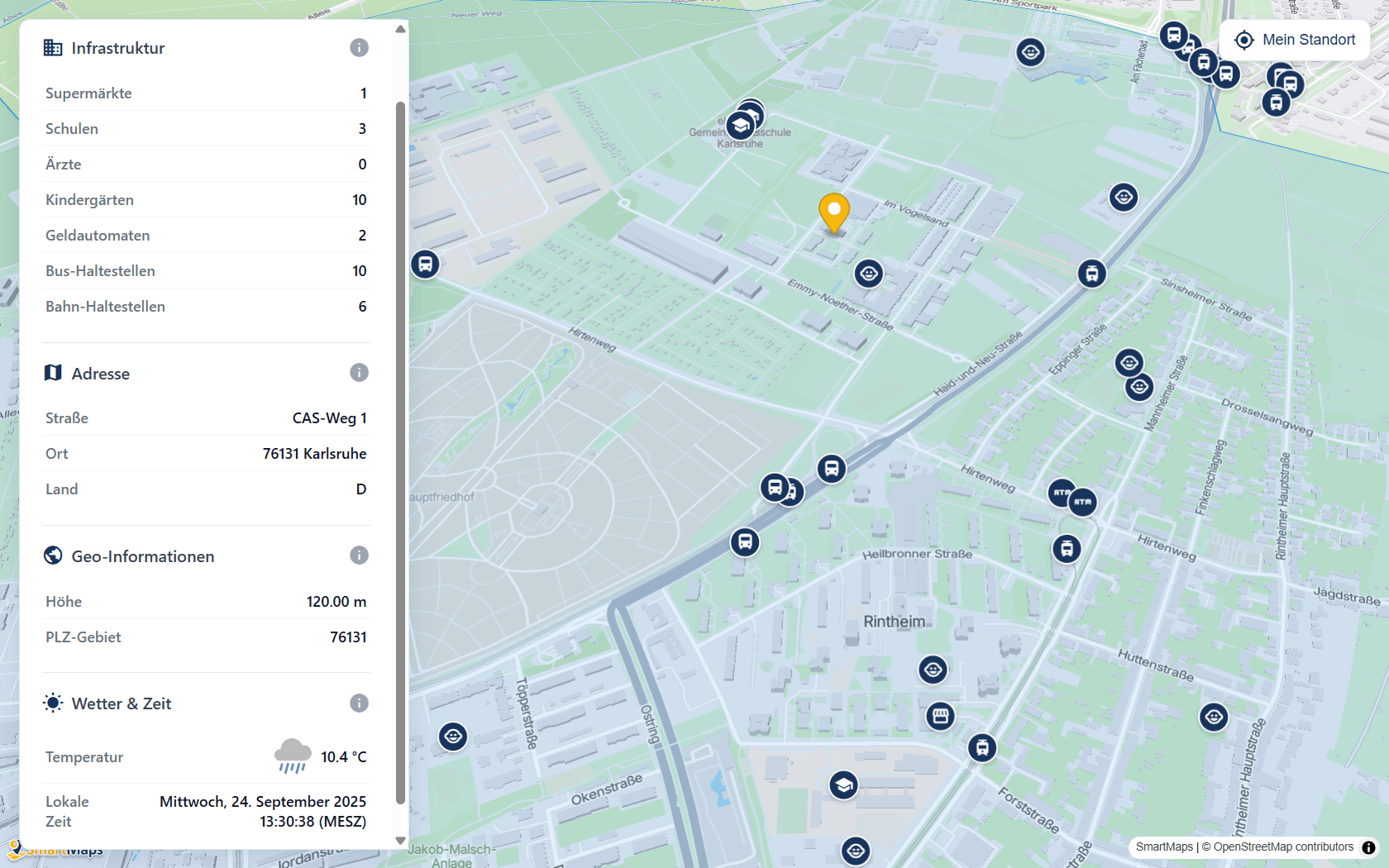
Interactive mapping solutions
- Location maps with custom markers
- Data visualisation as heatmaps or marker clusters
- Catchment area analysis for sales and marketing
- Geo dashboards for internal applications
System integrations
- CRM integrations: CAS, SmartWe, Salesforce, HubSpot
- ERP integrations: SAP, Microsoft Dynamics etc.
CMS plugins: WordPress, TYPO3, Drupal
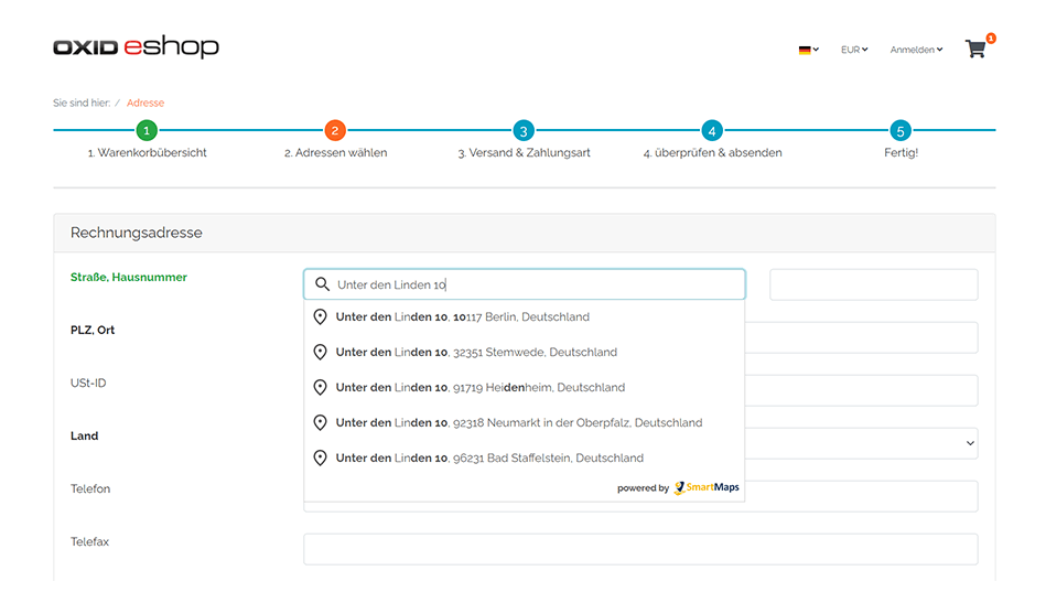
- E-Commerce integrations: Shopware, Magento, OXID, WooCommerce, Shopify etc.
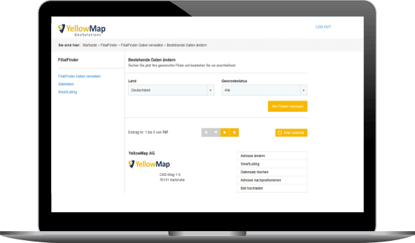
Data management & Geocoding
- Address cleansing and duplicate detection
- Geocoding of large data sets
- Address validation and postal standardisation
- Automated data import from your systems
Mobile & embedded solutions
- Native and hybrid app integration (iOS, Android)
- High-performance vector maps in native iOS/Android apps
- Location and campus maps with custom layers — including sites, buildings, and points of interest for hospitals, trade fair venues, or airport campuses
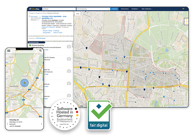
Search and finder solutions
- Store and location finders with routing and opening hours
- Dealer and service partner searches for manufacturers
- Click & Collect integrations for online shops
- Postal code and radius searches with custom filtering logic
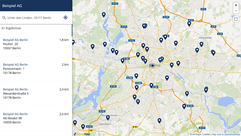
Built on the SmartMaps platform

Maps and vector maps
High-resolution vector maps with a custom map style, 3D visualisation, interactive layers, and retina sharpness on all devices.

Autocomplete
Intelligent real-time address autocomplete worldwide, available in 25 languages, and designed to reduce checkout errors.

Geocoding
Convert addresses into coordinates – and vice versa. Accurate geocoding and reverse geocoding for global location data.

Routing
Route planning, matrix routing, isochrones, and trip planning for logistics, service routes, and navigation.

Weather
Up-to-date weather data, UV index values, and environmental information directly on the map – ideal for outdoor, energy, and logistics applications.

Area & Elevation service
Area, elevation, and territory analysis for real estate, urban planning, and geospatial applications.
200+
139+

"SmartMaps impressed us primarily with its GDPR compliance, which is a high priority for us; an unbeatable price-performance ratio; and the truly outstanding technical documentation."
Philipp Klusmeier, Head of eCommerce reifencom GmbH
"From the very beginning, we had the feeling that YellowMap meets our requirements and that we are in good hands. Not least because the company has been specializing in exactly this area for over 20 years and brought corresponding references. The team conveyed to us: The schedule is ambitious, but we can do it. The cooperation is thoroughly professional, very dedicated, and it also fits on a human level. We get quick answers and clear statements. There are firm commitments on both sides. In short: teamwork as you would wish for it!"
Laura Peters, Team Lead Digital Marketing OTTO-CHEMIE

"For all interactive Sparkasse locators within the Sparkassen-Finanzgruppe, we have been relying on the service of YellowMap AG since 2022. The migration of over 365 regional Sparkasse websites and our central portal sparkasse.de to the GDPR-compliant map platform SmartMaps was easy, and we benefit from cost savings compared to our previous provider. We and our Sparkassen are enthusiastic about the new map solution, which is hosted on German servers."


"In order to comply with the strict GDPR guidelines, we had to look for an alternative mapping solution to Google Maps. With SmartMaps, we found a user-friendly mapping platform that protects the privacy of our customers. The switch was easy and completed with little effort."
"In general, I absolutely loved your customer friendliness (assistance, quick problem solving, incorporating changes) and always having the feeling of having a contact person."










Our project approach: transparent and collaborative
We work transparently, using agile methods, and in close collaboration with your team. Typical project duration: 6 to 12 weeks, depending on scope, data sources, and interfaces.
Analysis
We understand your goals, review the current state of your systems, and identify the best solution architecture.
2
Concept & Proposal
You receive a detailed concept including scope, architecture, timeline, and a transparent fixed-price or effort-based offer.
3
Agile implementation
We develop in three-week sprints with regular reviews, so you can track progress at any time and make adjustments as needed.
4
Launch & Operations
Go-live, training for your team, and ongoing operations in German data centres with a dedicated contact person for maintenance and support.
Privacy, security, and quality — certified multiple times
Certified by
BITMi

Hosting in Germany
100% GDPR-compliant

100% fair.digital
Frequently asked questions
I’m happy to help - how can I assist you?

Christopher Schmitt
Maps-Specialist
Tel.: +49 721 9638-125
geosolutions@yellowmap.de
