

Visualise your data – fully GDPR-compliant, with no cloud uploads: SmartMaps Monitor
SmartMaps Monitor is the GDPR-compliant mapping solution for businesses that need to visualise data on interactive maps without transferring sensitive information to the cloud. Hosted in Germany, easy to integrate, and available from just €99 per month. Display locations, vehicle fleets, assets, or IoT devices on powerful interactive maps while keeping your data entirely within your own infrastructure. Start with a free six-month trial.
Map Visualisation in Practice: Locations, Risks, and Business Data
From vehicle fleets to climate data and branch sales figures, SmartMaps Monitor makes your data actionable across a wide range of use cases. Insurance companies, energy providers, real estate companies and municipalities use it to visualise locations, risks and business metrics on interactive, GDPR-compliant maps without relying on an external cloud.

Locations & Fleets in Real Time
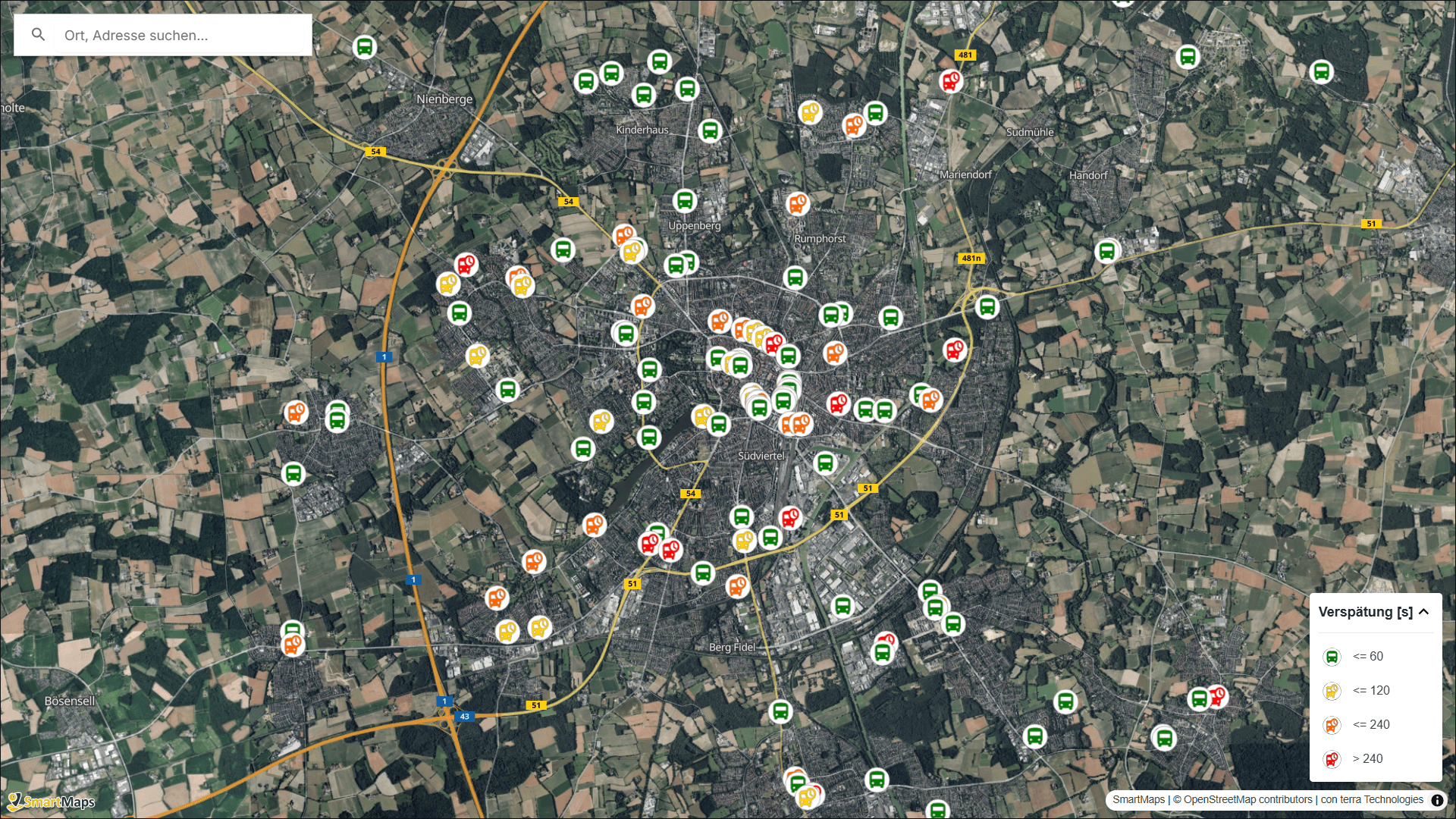
Visualise e-scooters, car-sharing vehicles, rental bikes or delivery fleets in seconds, fully GDPR-compliant. This includes live status data for battery levels, tyre pressure and maintenance requirements, without any location or movement data leaving your system.

Early Risk Area Identification
Visualise flood risk, UV exposure, and pollen forecast data on interactive maps. Insurance providers, municipalities, and healthcare organisations can therefore inform customers, employees, or citizens at an early stage – including integration with external climate data sources.

Analyse Business Data Geospatially
Identify top-performing sales regions in combination with purchasing power indices at postcode level or monitor rental price trends at a glance. This is ideal for retail chains, store location planning, municipalities, and real estate analysis.
Why SmartMaps Monitor is the GDPR-Compliant Mapping Solution for Businesses
Full Data Sovereignty: Your Geodata Never Leaves Your System
- On-premises or in your private cloud – you operate SmartMaps Monitor within your own infrastructure and retain full control over data and access
- No telemetry to third parties – no tracking, no analysis of your map usage by external providers
- Certified under “Software Hosted in Germany” and fair.digital – independent certifications for data protection and fair business practices

Applications: How Companies use SmartMaps Monitor
Mobile Asset-Tracking: Real-Time GDPR-Compliant Location of Vehicles and Devices
SmartMaps Monitor tracks the location of mobile assets such as e-scooters, rental bikes, car-sharing vehicles, or delivery fleets (at configurable intervals) on interactive maps - without transferring movement data to external cloud providers. As well as position data, the software visualises device status information such as battery level, tyre pressure, temperature and upcoming maintenance needs directly within the map context.
- Continuously updated location tracking for vehicles and mobile assets
Live device status on the map: battery level, tyre pressure, temperature, maintenance needs
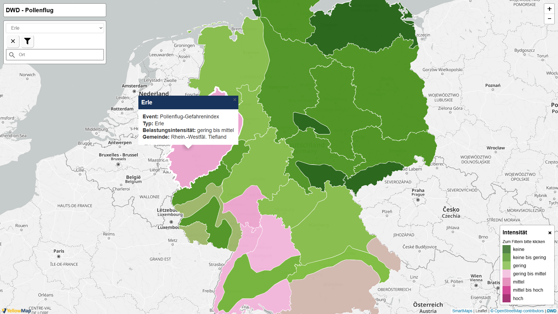
Risk Analysis & Environmental Data: Visualising Flood, Weather, and Pollen Zones on the Map
- Environmental data overlays: weather, UV index, pollen count, air quality, water levels
- Dynamic risk zones based on live data or custom risk parameters
Location Analysis & Market Potential: Spatial Evaluation of Sales, Branches, and Catchment Areas
Sales and performance heatmaps at store level, postcode areas, or sales regions
- Location comparisons and benchmarking between stores, branches, or competitor locations
- Catchment area analysis with purchasing power index, competition density, and demographic data
- Market potential visualisation for expansion, site planning, and white spot analysis
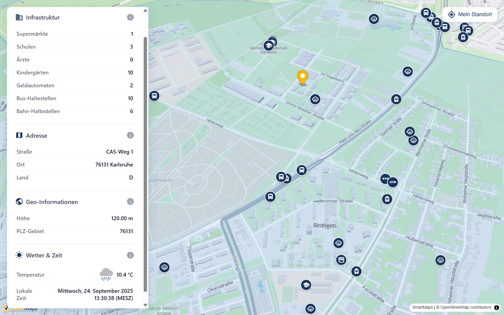
Industries: Map visualisation for Sharing & Mobility, Real Estate, Energy, Insurance, Logistics & Fleet, Public offices, and many more

Sharing & Mobility
Track and manage e-scooters, rental bikes, and car-sharing fleets in real time on a map.

Real Estate
Spatially analyse and visualise rental prices, zoning districts and infrastructure developments.

Energy
Visualise network infrastructure, wind farm locations, and utility service areas on interactive maps.


Logistics & Fleet
Track vehicle fleets, visualise route planning, and analyse delivery areas.

Public Offices
Display infrastructure, environmental data, and public services on accessible maps.
Certified Security - made in Germany
Certified by
BITMi

Hosting in Germany

100% GDPR-compliant

100%
fair.digital
FAQs about SmartMaps Monitor: GDPR, Pricing, and Integration
I’m happy to help - how can I assist you?

Christopher Schmitt
Maps-Specialist
Tel.: +49 721 9638-125
geosolutions@yellowmap.de
