


You just saw a SmartMaps map.
The trusted choice for businesses worldwide
The interactive map that brought you here is powered by SmartMaps – the mapping platform by YellowMap AG. SmartMaps is GDPR-compliant, hosted in Germany, and combines maps, geocoding, routing and many more geo services under a single API. Whether it's a store locator, a location map or a custom application – if you'd like maps like these for your own website or app, you're in the right place.
Data attribution for SmartMaps
We rely on OpenStreetMap
Our maps and services are based on OpenStreetMap data. OpenStreetMap is open data, licensed under the Open Data Commons Open Database License (ODbL) by the OpenStreetMap Foundation (OSMF).
Our maps must always show our logo and the following attribution:
© SmartMaps © OpenStreetMap contributors
Additional data
More than OpenStreetMap
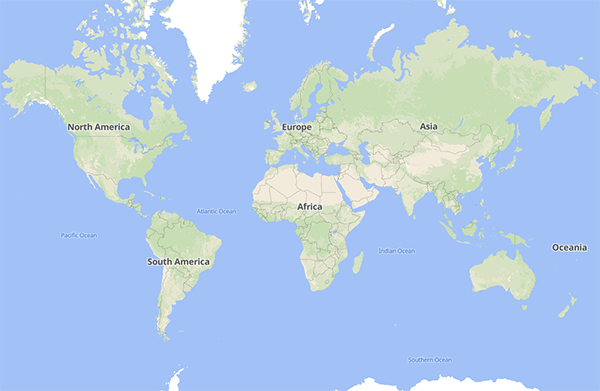
Landcover data of the Earth
ESA WorldCover 2020
SmartMaps integrates datasets from the European Space Agency (ESA) Climate Change Initiative, particularly those generated through the Land Cover project.
This global landcover data, derived from Sentinel-1 and Sentinel-2 satellite imagery, offers a detailed and consistent representation of the Earth's surface. The ESA WorldCover dataset is a valuable resource, providing a comprehensive classification of various land cover types, including forests, grasslands, wetlands, urban areas, and more.
Terrain data of the Earth
JAXA and Natural Earth data
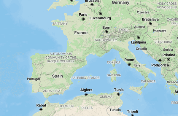
SmartMaps incorporates datasets from the Japan Aerospace Exploration Agency (JAXA), specifically the ALOS World 3D - 30m (AW3D30) digital surface model. This global terrain data, derived from the ALOS satellite’s Panchromatic Remote-Sensing Instrument for Stereo Mapping, offers a detailed and consistent representation of the Earth's topography.
SmartMaps also utilise Natural Earth Bathymetry data to accurately depict ocean depths. This detailed dataset provides a comprehensive view of the ocean floor, which is essential for marine navigation, environmental research, and oceanographic studies.
Satellite data
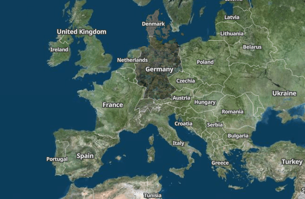
Satellite imagery for Europe
SmartMaps include data from the national mapping agencies and geodata institutes of Germany, Austria and Switzerland, in particular high-resolution orthophotos and digital surface models.
These nationwide high-resolution aerial imaging datasets, captured through modern aerial survey systems, deliver a detailed and consistent view of the Earth's surface. The orthophotos and digital surface models are valuable resources, providing a comprehensive representation of various land cover types such as forests, grasslands, wetlands, urban areas, and more.
Germany: © GeoBasis-DE / BKG 2024
Austria: © CC-BY 4.0 BEV - Bundesamt für Eich- und Vermessungswesen
Switzerland: © swisstopo
Denmark: © CC-BY 4.0 GeoDanmark
France: © IGN Photographies aériennes

Weather data
Worldwide weather information
SmartMaps incorporate datasets from several weather services and the Open-Meteo framework to deliver high-quality weather and climate information. The DWD provides comprehensive geospatial weather data derived from its extensive meteorological network, ensuring accuracy and reliability. Open-Meteo processes data from various national weather services and leverages open-source technology to provide detailed weather forecasts.This integration enables SmartMaps to offer precise and detailed weather data.
DWD: © CC-BY 4.0 Source: Deutscher Wetterdienst (DWD)
ECMWF: © CC-BY 4.0 Source: European Centre for Medium-Range Weather Forecasts (ECMWF)
Copernicus: © Copernicus Climate Change Service C3S
Open-Meteo: © CC-BY 4.0 Open-Meteo.com


Start for free or consult with our experts today!
Let's unlock your mapping potential together
Your success is our priority - Connect with us now
Have questions or seeking personalized guidance on our SmartMaps platform? I'm here to help. Contact me today for expert advice and support in achieving your goals with our cutting-edge mapping solutions.

Christopher Schmitt
Maps-Specialist
Tel.: +49 721 9638-125
geosolutions@yellowmap.de